Today, Wednesday, March 12, the City of Ashland and Ashland Parks and Recreation will manage controlled burns to consume burn piles on City-owned forest lands around Liberty Street on an undeveloped open space and around Red Queen Trail. Rogue River Siskiyou National Park is also managing a burn around White-Rabbit Trailhead. A fourth private burn is being managed at the top of Strawberry Lane. With predicted rain and weather coming in, we expect smoke to quickly disperse.
Predicted Smoke Impacts: Smoke will briefly impact areas surrounding Upper Morton Street and S. Mountain Ave and adjacent neighborhoods around SOU and the high school. You may see or smell smoke near the controlled burn around neighborhoods adjacent to upper Morton, S. Mountain Ave and Strawberry Lane. Smoke from the burn could impact White-Rabbit Trailhead and Red Queen this morning.
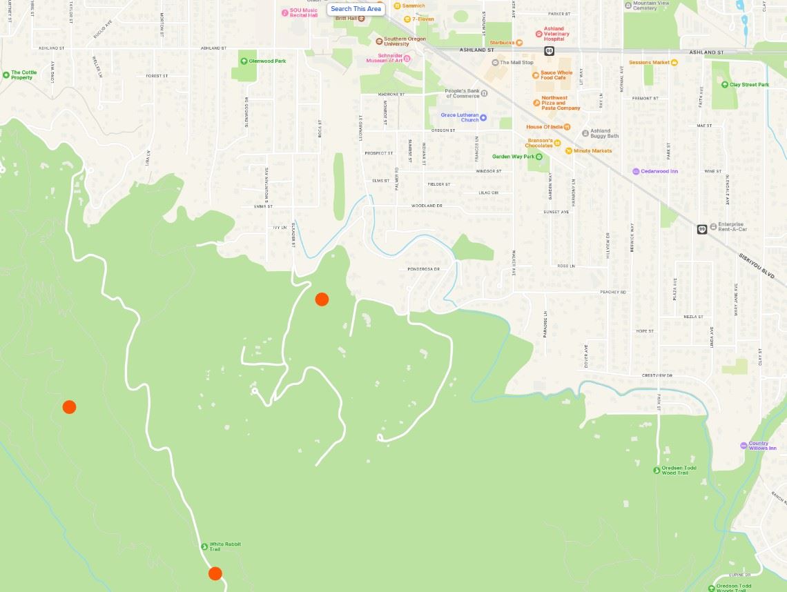
| Location of Controlled Burn | City Forest Lands around Liberty Street. See the map below. |
| Date(s) of Controlled Burns | Wednesday, March 12 |
Potential Smoke Impacts | Neighborhoods above SOU and around upper Morton and S. Mountain Ave, above Strawberry Lane. Smoke may impact White-Rabbit Trailhead and Red Queen Trail. Smoke could be visible from different parts of town and from the I-5 freeway. |
| What to do if smoke is in the air | The City’s Smokewise Ashland site has all the resources you need to stay healthy. |
| More information | smokewiseashland.org |
Where is the Controlled Burning?
There is four locations today:
- Liberty open space property
- White-Rabbit Trailhead
- Red Queen Trail
- Above Strawberry Lane in open space
Why Burn?
For time immemorial Indigenous peoples used fire as a land management tool and research has shown that burning accumulated fuel is an important step to restore forest resilience and reduces severe summer wildfires in our municipal watershed and community. Our primary objective when using prescribed fire is the safety and well-being of our community and fire crews. Learn more about how proactive fire planning is used to prioritize our work and guide summer fire response. The City of Ashland works in partnership across city forest lands, with private landowners and on public land for improving community wildfire risk reduction.
Stay Informed with Non- Emergency Smoke and Controlled Burning Notifications
Controlled burns will continue throughout spring and several burn locations are close to town. Smoke is expected to impact recreation trails and the community. Text WATERSHED in the message line to 888777 for non-emergency text notifications about City of Ashland controlled burns, smoke, forest management activities and events for community risk reduction.