UPDATE 12:00 PM Friday:
Smoke from the Ashland Watershed will be more visible this afternoon as fire crews from the U.S. Forest Service- Rogue River-Siskiyou National Forest and Grayback Forestry, Inc. work to line and burn out an area that had reignited after a previous pile burn. Conditions up high are abnormally warm and dry. Smoke will temporarily increase this afternoon during the burn out, which accomplishes the same goals as our spring underburning to remove hazardous surface fuel buildup and return good fire to the ecosystem....just a few months early this year. There is no threat to property or people from this burn.
Smoke will affect the 2060 road north of Horn Gap and the 2060-200 road including Horn Gap trail, Ricketty Trail, and the No Candies trail. If you are sensitive to smoke, please avoid these areas of the western Ashland Watershed. The burn area is circled in yellow on the map below with the number 22 in the middle.
We do not expect smoke to be an issue in the valley, but if you area particularly sensitive to smoke please take precautions found at www.smokewiseashland.org
PREVIOUS POST
There is some residual smoke in the Ashland Watershed near Horn Gap from recent controlled burns. The U.S. Forest Service- Rogue River-Siskiyou National Forest is aware and has resources ordered for tomorrow (Friday) to address remaining smoke that's popping up above the ridge and visible from the valley. There is no threat to the watershed or community. Recreationalists might want to avoid the area (2060-200, Horn Gap, Ricketty trail) due to smoke. Please do not report the smoke, thank you!
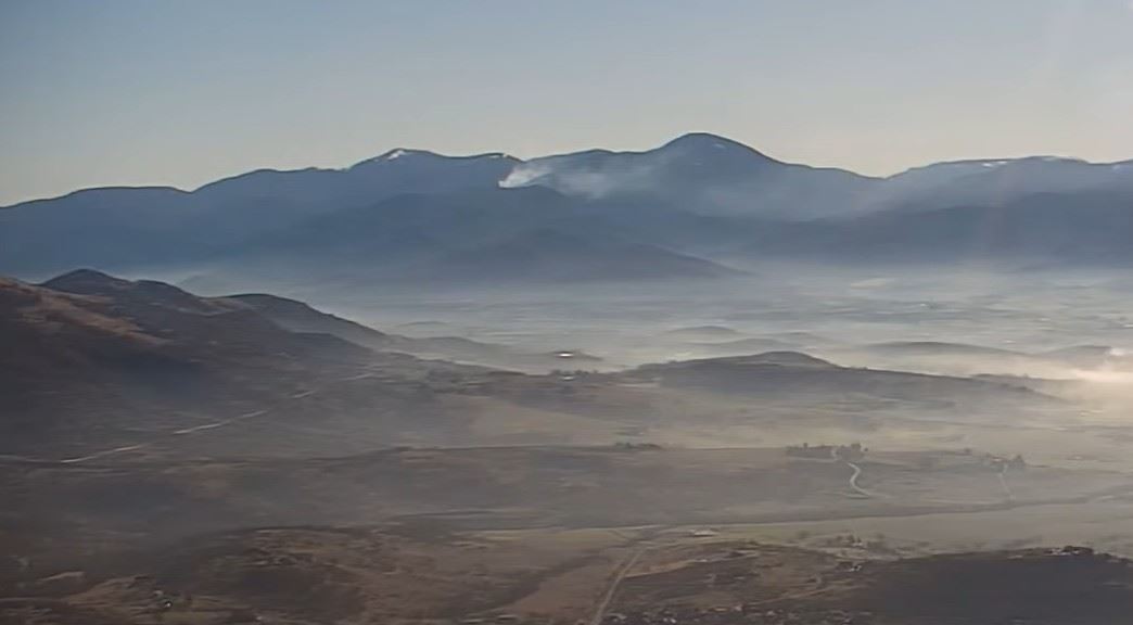 Smoke as seen from Roxy Ann Butte, 4:00 PM Thursday